Coral reefs cover more of Earth’s surface than realized, new estimates reveal.
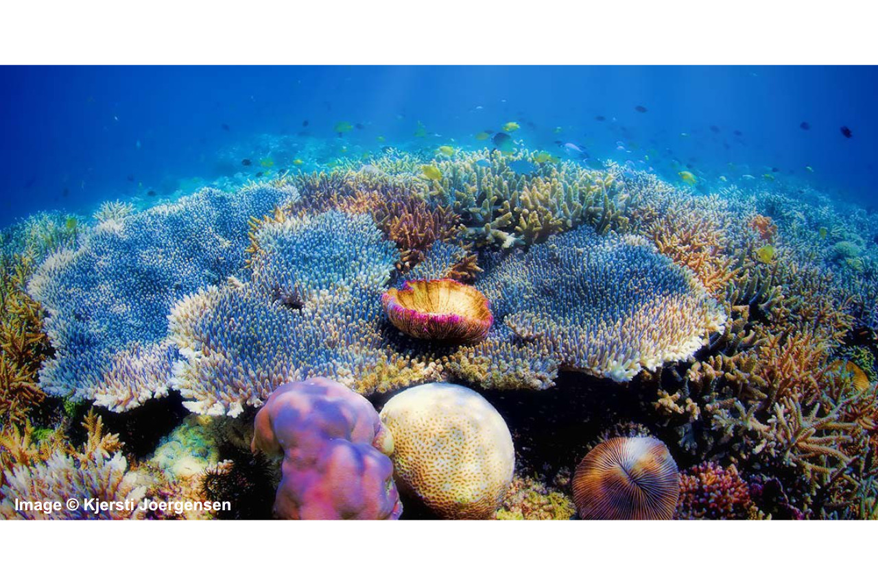
A recent study utilizing satellite imagery has unveiled a significant discovery regarding the extent of coral cover worldwide. The research has identified a previously unrecognized 64,000 square kilometers of coral, equivalent to the size of Ireland. Consequently, the total area of the world's coral reefs now stands at an impressive 348,000 square kilometers. Despite representing a mere 0.1% of the Earth's oceans, coral reefs play a crucial role as marine habitats, supporting an estimated 25-40% of all marine species while also safeguarding coastlines and sustaining millions of livelihoods. However, these invaluable ecosystems face threats such as climate change, overfishing, and pollution. Nevertheless, researchers express optimism that by comprehensively mapping coral reefs, conservation efforts can be significantly enhanced. Dr. Mitchell Lyons, the study's lead author from the University of Queensland, highlights the significance of this work as it provides the first accurate depiction of coral reef distribution and composition, accompanied by clear and consistent terminology.
The study, published in Cell Reports Sustainability, introduces a groundbreaking mapping tool with far-reaching implications for coral reefs and marine environments. Part of the broader Allen Coral Atlas project, this tool promises to empower scientists, conservationists, and policymakers in their efforts to understand and manage reef systems effectively. Enabled by advancements in satellite technology, particularly the utilization of Dove CubeSats, the atlas provides global estimates of coral cover, a feat made possible only in recent years. By combining data from Dove CubeSats with images from the European Space Agency's Sentinel-2 satellites, researchers achieved an unprecedented level of detail in mapping Earth's coral reefs. The resulting map spans 348,361 square kilometers of shallow coral reefs, approximately 1.5 times the size of the UK, offering invaluable insights into the state and dynamics of these critical ecosystems.
The study highlights that while the mapped area of
coral reefs totals approximately 348,361 square kilometers, only around 80,000
square kilometers actually host coral. The remainder consists of areas
classified as parts of coral reefs but currently lack coral, potentially
housing other reef organisms such as algae and seagrass. Additionally, the
mapping effort has provided comprehensive documentation of coral-rich seas
surrounding Indonesia and Australia for the first time, revealing Indonesia as
the most coral-rich country, with approximately double the coral coverage of
Australia. Coral bleaching, a phenomenon caused by stress-induced expulsion of
symbiotic algae from coral, poses a significant threat to these ecosystems. To
address this, the research team aims to maintain the coral atlas's relevance by
continually updating and refining its data to track changes in coral reefs over
time, particularly in response to escalating threats. Integration of data from
various sources, such as records of bleaching events, enables the
identification of areas at higher risk of temperature-induced stress,
facilitating prompt interventions to mitigate coral damage.
The research underscores the importance of swift responses to coral bleaching events, as rapid interventions such as shading at-risk corals can facilitate their recovery. Early alerts, therefore, offer nations a crucial opportunity to safeguard corals during periods of elevated temperatures. Moreover, the warming of ocean temperatures is contributing to the intensification of tropical cyclones, posing a grave threat to fragile coral reef ecosystems. The loss of these reefs not only disrupts marine biodiversity but also impacts communities dependent on them for livelihoods, whether through tourism or fishing. Consequently, countries are leveraging the coral atlas to strategize recovery and restoration efforts. For instance, Vanuatu anticipates increasingly erratic and coral-damaging cyclones due to climate change, making the map invaluable for identifying priority areas for restoration. Similarly, in the Seychelles, coral mapping informs assessments of the reefs' value to the tourism industry, aiding in future planning efforts. Armed with these tools, researchers are optimistic about the prospects of coral survival amidst the challenges of the twenty-first century. To learn more, head to James Ashworth’s article in Natural History Museum https://www.nhm.ac.uk/discover/news/2024/february/coral-reefs-cover-more-earths-surface-than-realised-new-estimates-reveal.html